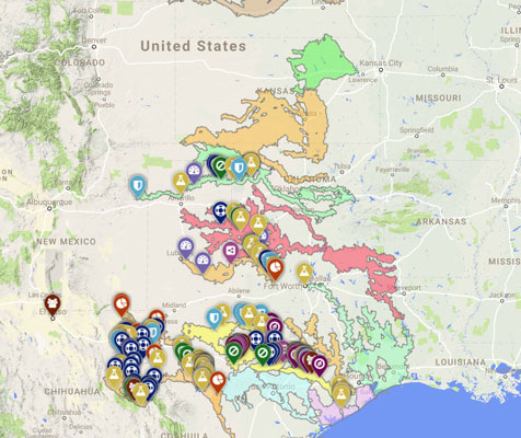
 Through support from Southern Rockies Landscape Conservation Cooperative (SRLCC), Desert Fish Habitat Partnership (DFHP), Western Native Trout Initiative (WNTI), and Siglo Group, a NFCA prioritization was completed that identifies focal watersheds for preservation of freshwater fish diversity within Rio Grande watershed.
This multispecies, watershed-based conservation prioritization is now being used to facilitate cooperative conservation of aquatic resources within the basin, supporting local implementation of the National Fish Habitat Action Plan through stakeholder planning and facilitation workshops.
PROJECT TITLE
Rio Grande Fishes Conservation Assessment and Mapping
PROJECT PARTNERS
Southern Rockies Landscape Conservation Cooperative (SRLCC), Desert Fish Habitat Partnership (DFHP), Western Native Trout Initiative (WNTI), and Siglo Group


PROJECT GOAL
Partners in the region are using this multi-species, watershed-based framework to facilitate cooperative planning and collaborative conservation of aquatic resources within the watershed.
PROJECT OBJECTIVES
- Conduct an overall characterization of the Rio Grande Watershed to identify areas appropriate for the efficient implementation of habitat-related projects and priority land and stream segments.
- Create an informative, compelling tool that identifies areas of highest conservation value in the watersheds and supports and catalyzes action by stakeholders, decision makers, and conservation practitioners.
PROJECT BENEFITS
This project is intended to advance the cooperative conservation of Rio Grande basin rivers and native fishes, and provide a catalyst for development of watershed-based conservation partnerships that will implement a proposed network of Native Fish Conservation Areas in the basin.
BACKGROUND
This conservation assessment of the U.S. Rio Grande Watershed identifies target areas for the implementation of habitat-related projects and priority areas, stream segments, and watersheds to improve ecological condition, restore natural processes, and prevent the decline of intact and healthy systems. Through systematic conservation planning, this assessment addresses multi-species and multi-jurisdictional concerns; work that complements and extends analogous conservation assessments completed for much of the Desert Landscape Conservation Cooperative’s (DLCC) extent. In doing so, it provides a flexible working model into which priority taxa and habitats can be easily incorporated in the future.
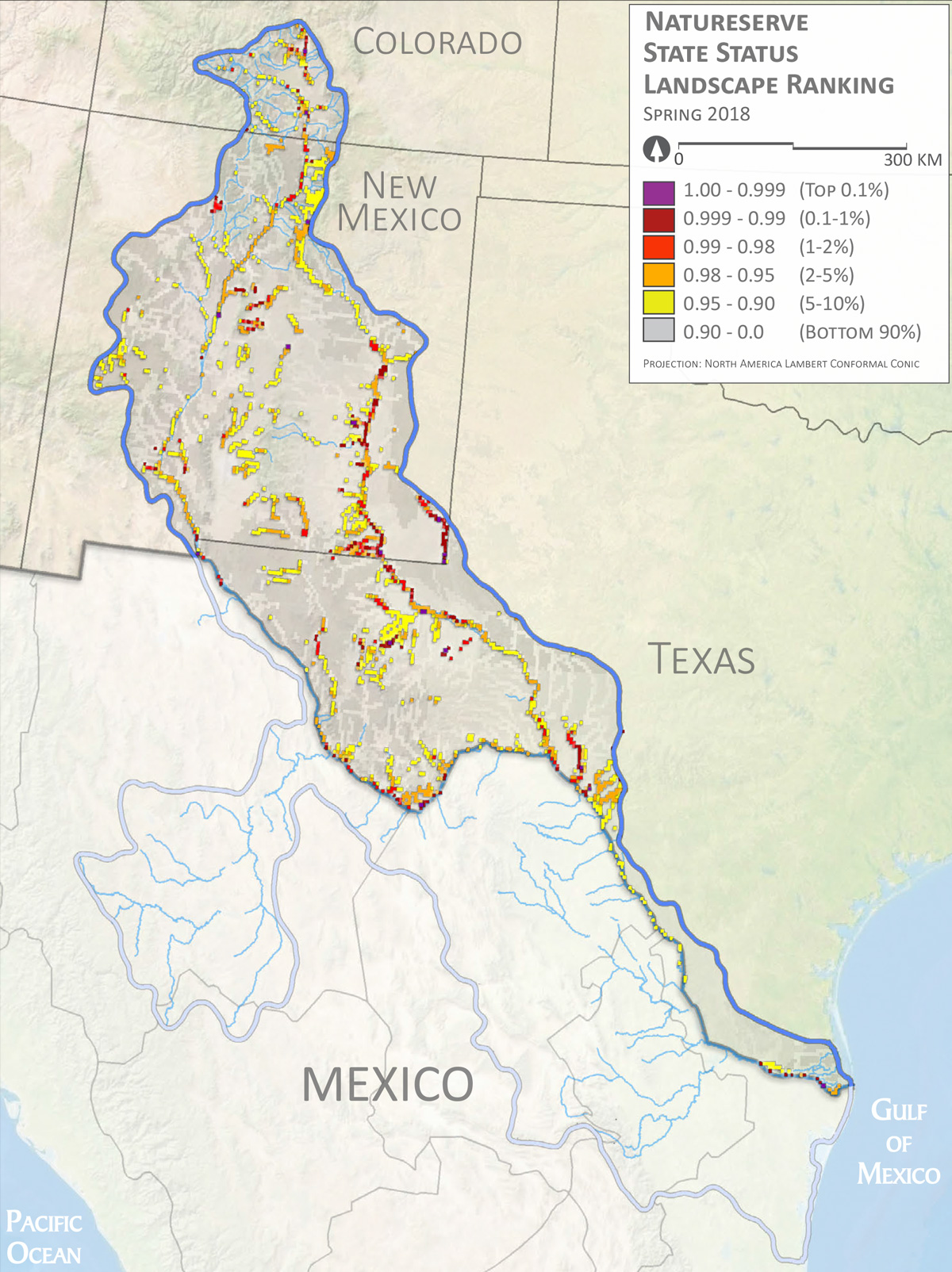
The assessment combines practices used in Texas (Hendrickson et al. 2016) and for the Great Plains Landscape Conservation Cooperative (GPLCC) (Labay and Hendrickson 2014) with those from the Upper Snake River Basin and the Upper and Lower Colorado Basins (Dauwalter et al. 2011, Whittier and Sievert 2014, Williams and Dauwalter 2013). Specifically, this work utilizes the open source software Zonation (Moilanen 2007) to perform a spatial prioritization analysis that explicitly incorporates species-specific connectivity requirements and responses to fragmentation (Williams et al. 2011). Much of the species data and initial modeling needed for the assessment were drawn from the work of Cohen et al. (2013). Where priority taxa were not included in Cohen et al. 2013, species representation was incorporated via binary presence/absence data at a USGS hydrologic unit 8 or 12, based on data availability and the guidance of species experts (who were engaged as stakeholders in this project). The final products of the models are three different sets of stream prioritization coverages and landscape management areas, based on distinct units of unique priority species assemblages (Figures 5-10). These products are intended to facilitate communication and coordination, and ultimately conservation action (Fausch et al. 2002).
Implementation of this broad-scale multi-species approach complements traditional reactive management and restoration by encouraging cooperation and coordination among stakeholders and partners, and by increasing the efficiency of future monitoring and management efforts. The products of this assessment support managers, at different administrative levels, in the effective allocation of conservation resources through proactive, species-centric planning. Furthermore, results of the assessment lay the groundwork for the coordination and cooperation of multiple agencies and organizations as they identify areas for priority conservation, habitat improvement actions, and long-term monitoring and management.