The conservation prioritization completed by Labay and Hendrickson (2014) offers data-driven guidance and science-based justification for selection of priority river systems to advance conservation planning and delivery in the Great Plains and has broad application potential and transferability to other watersheds. The river systems and associated watersheds identified through this prioritization have now been adopted by the Southeast Aquatic Resources Partnership and Great Plains Fish Habitat Partnership as priorities for establishment of a proposed network of Native Fish Conservation Areas in the Great Plains.
The full assessment report and analysis products can be found HERE.
- Creation of species distribution models for 28 priority Great Plains fish taxa (see table below).
- A spatial prioritization analysis that identifies focal areas for conservation based on representation.
- A spatial framework for landscape-scale resource management via identification of high-priority taxa management units (Native Fish Conservation Areas, NFCAs) based on distance and compositional similarity of the top tier prioritized streams.
Methods Overview
New Species Distribution Models (SDMs) for Species of Greatest Conservation Need (SGCN)
We used species distribution models to convert point occurrence data into range-wide continuous probability coverages. Fish species were chosen on the basis of their state and federal conservation rankings and the authors’ expert opinion (Table 1).
Prioritization Assessment for SGCN Fishes
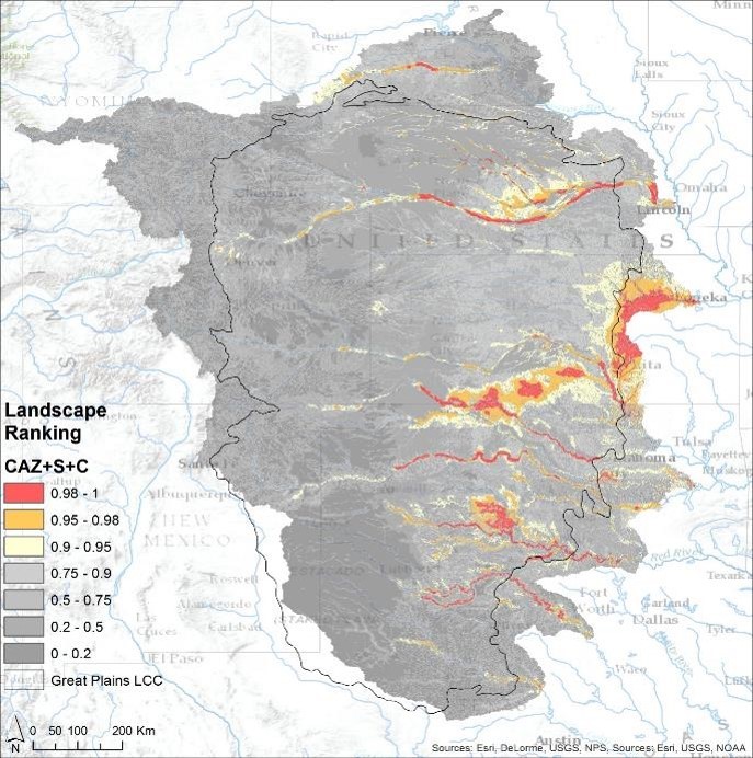
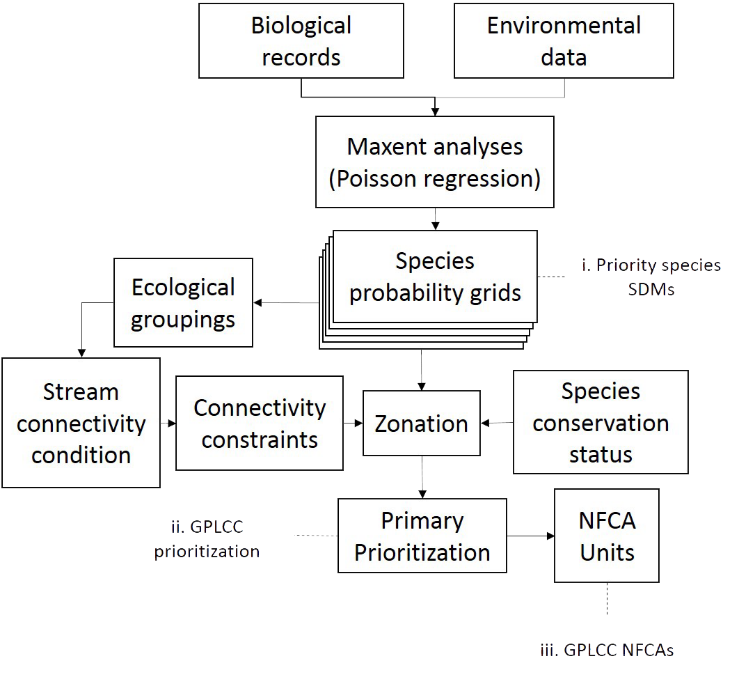
For spatial prioritization of core habitat for priority fishes in the Great Plains we use the planning software Zonation (Moilanen et al. 2005). The primary function of the software is to produce a landscape ranking based on conservation value defined by spatially explicit levels of species, habitat, or ecosystem occurrence. It does this in our case by initially considering the entire landscape being analyzed and iteratively removing spatial grid cells that result in the smallest loss of conservation value, as defined by SDM estimation of relative probability of occurrence. Zonation allows alternative implementation of the cell removal process and what type of conservation value it emphasizes. The removal rule used in this study is one that emphasizes species rarity (Core-Area Zonation, CAZ; Moilanen et al., 2005), which aims to identify ‘core’ priority landscapes for each species regardless of overall species richness. The intent with the CAZ approach is to identify the set of core areas most relevant for conservation of all priority species.
By incorporating the SDMs, a primary prioritization was produced. It utilized the core area removal process and incorporated species-specific weighting, connectivity constraints, ecological groupings, and a stream connectivity condition factor (Figure 2). See Labay and Hendrickson (2014) for detailed methodology.
Native Fish Conservation Areas
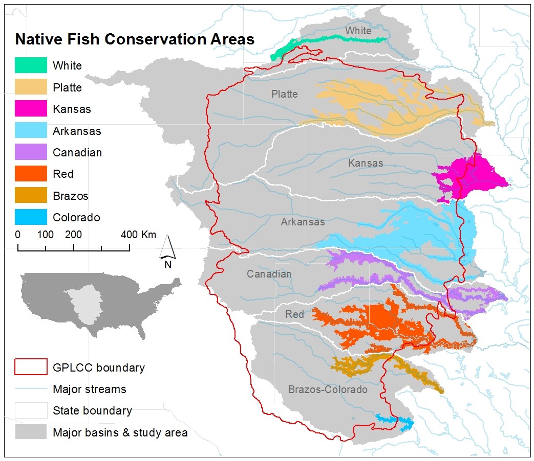
Zonation allows for the identification of distinct species-based geographic units (here called NFCAs) based on the distance and compositional similarity between priority areas. This is done using four user-specified parameters:
i.) % of the landscape to consider for inclusion in the management units,
ii.) minimum inclusion top fraction for each unit (what top fraction must be present in each separate unit),
iii.) a maximum distance between units, and
iv.) a maximum difference in compositional similarity between units.