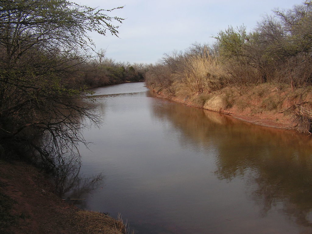
Upper Red River NFCA Profile
...wide and shallow and characterized by sandy substrates
Conservation Profile
Ecoregion
Southern Plains
Biotic Province
Kansan
Stresses
Primary threats include groundwater extraction, habitat fragmentation, dewatering, flow regime alteration, water pollution, and introduction of non-native species including invasive Saltcedar
Partners
US Army Corps of Engineers, FWS: Red River NWR, Levee boards, Red River Watershed Mgmt Institute, Red River Valley Association, Red River Compact Commission,
Fishes of concern
American Eel (Anguilla rostrata)
Goldeye (Hiodon alosoides)
Plains Minnow (Hybognathus placitus)
Prairie Chub (Macrhybopsis australis)
Shoal chub (Macrhybopsis hyostoma)
Silver Chub (Macrhybopsis storeriana)
Red River Shiner (Notropis bairdi)
River Shiner (Notropis blennius)
Chub Shiner (Notropis potteri)
Suckermouth Minnow (Phenacobius mirabilis)
Red River Pupfish (Cyprinodon rubrofluviatilis)
River Darter (Percina shumardi)
The Red River Basin is one of two large river basins draining the southern Great Plains (Matthews et al. 2005). It was named for the color it takes on during flood events as the red soils that characterize the region wash in (TSHA). Its headwaters comprise of two forks that originate on the Llano Estacado of the Texas panhandle, the Prairie Dog Town Fork and the North Fork. These join at the Texas-Oklahoma border, near Vernon, Texas. The Red traverses 1,360 miles, and its watershed drains portions of Texas, Oklahoma, Arkansas, and Louisiana. The River ends near Simmesport, Louisiana where it empties into the Mississippi and the Atchafalaya Rivers (RR Watershed Management Institute).
“Principal tributaries of the Red River, exclusive of its various forks, include the Pease and Wichita rivers in north central Texas, the Sulphur River in Northeast Texas, and, from Oklahoma, the Washita. The Ouachita is the main tributary in its lower course.” (TSHA) “Four major reservoirs with impoundment capacities greater than 200,000 acre-feet are in the basin: Lake Kemp, Lake Kickapoo, Lake Arrowhead, and Lake Texoma” (USGS).

In the Red’s upper portions in the west, among the short and mixed grasses that characterize the arid high plains, flow is uncertain and may pool in dry times. Further, brine springs emananting from the Permian Redbeds contribute to high salinity, in some places higher than seawater. These conditions separate the upper and lower river, structuring the biota. Some headwaters are limited to a couple of hardy, salt-tolerant fishes (RR pupfish & plains killifish). As it flows down from the forks through taller grasses and cross timbers, the sandy-muddy river is wide and shallow with high variation in discharge. It becomes a substantial river as it nears Lake Texoma, a major impoundment where the Washita tributary joins the red. Below Lake Texoma, the flow becomes more consistent as it passes through areas of southern bottomland hardwoods, swamps, and oxbow lakes. The more consistent flow and dilution from tributaries contribute to a higher fish diversity, “and salinity gradients that would structure biota are lacking” (Matthews et al. 2005).
Historically, navigation along the Red was treacherous due to the “great raft”, a 150 mile stetch of discontinous logjams extending from present-day Natchitoches to the Louisiana-Arkansas state line (Corps). As the Red River moved back and forth across its alluvial flood plain, it felled trees, creating the log jams (Matthews et al. 2005, Corps). The raft raised the river level, forming transitory overflow lakes, many of which have been lost. Some of the raft lakes, such as Caddo Lake, were preserved by building dams. The removal of the raft in 1874 caused the river to scour its channel leading to the formation of high banks which in turn led to the erosion of farmland. Further, massive bars developed downstream and shoaling interfered with navigation. In 1994, The $1.9 billion Red River Waterway Project (authorized by Congress with the River and Harbors Act of 1968) was completed. The dredging of a channel 9 feet deep and 200 feet wide along with the construction of a series of five lock and dam systems improved navigation from the Mississippi River to Shreveport. The project also funds the realignment and stabilization of the Red River banks through dredging, dikes, and other structural methods (Corps).
The river retains many of its natural characterisitics, despite these human alterations. Below Lake Texoma, the river flows through mostly rural regions and still “overflows into oxbows and swamps throughout much of its lower course”. However, the U.S. Army Corps of Engineers has long planned a massive chloride removal project that threatens the natural salinity gradient structuring the biota of the upper river (Matthews et al. 2055). Further, this high salinity is the greatest limitation on water use in the basin (USGS). Rendering the water available for agriculture or growing municipalities such as Wichita Falls would substantially increase withdrawals (Matthews et al. 2005, news article). Headwater streams often dry to isolated pools in summer. Lower river levels would contribute to more frequent drying as well as impact larger refugia streams necesseary for recolinization (Petition, Matthews et al. 2005). Further, reduced salinity could impact the lucrative Lake Texoma striped bass fishery.
Existing Conservation/Research Efforts:
- …”national advocacy group American Rivers named the Red River one of its 20 “threatened rivers,” largely due to a chloride control project, which the group said could eliminate shrub land and transform the river channel (News article)
- “Red River Watershed RCPP Project is a voluntary program that provides financial …and technical assistance to farmers for addressing water quality concerns in some tributaries…”: http://www.rrva.org/Red%20River%20RCPP%20Fact%20Sheet.pdf
Sources:
Matthews et al. 2005: This is an excellent resource for info on any river it characterizes. http://www.biosurvey.ou.edu/download/publications/South_Plains_River_Complete.pdf
TSHA (Texas State Historical Association): https://tshaonline.org/handbook/online/articles/rnr01
Red River Watershed Management Institute: http://www.lsus.edu/offices-and-services/community-outreach/red-river-watershed-management-institute/about-the-basin
USGS: https://pubs.usgs.gov/fs/fs-170-97/FS_170-97.htm
Corps (US Army Corps of Engineers): http://www.mvk.usace.army.mil/Missions/Recreation/J-Bennett-Johnston-Waterway/
